| Dniester Canyon National Nature Park | |
|---|---|
| Ukrainian: Національний природний парк «Дністровський каньйон» | |
 Dniester Canyon National Nature Park | |
| Location | Ternopil Oblast |
| Nearest city | Zalishchyky |
| Coordinates | 48°39′00″N 25°44′06″E / 48.65°N 25.735°E |
| Area | 10,829.18 hectares (26,759 acres; 108 km2; 42 sq mi) |
| Established | 2010 |
| Governing body | Ministry of Ecology and Natural Resources (Ukraine) |
| Website | http://dnistercanyon.pp.ua/index.php/en/ |
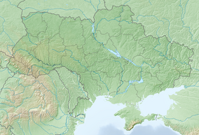
Dniester Canyon National Nature Park (Ukrainian: Національний природний парк «Дністровський каньйон») follows Dniester Canyon, the largest canyon in Ukraine, along the middle course of the Dniester River. It protects a relatively undeveloped portion of the Ukrainian forest-steppe landscape, about 75 km east of the Carpathian Mountains in western Ukraine, and about 400 km southwest of Kyiv. The canyon is known for its varied geological formations, including two of the longest caves in the world. It is in the administrative district of Chortkiv Raion in Ternopil Oblast.[1][2]
- ^ "Dniester Canyon National Nature Park". Park Site. Retrieved February 27, 2019.
- ^ "Decree of the President of Ukraine establishing NNP Dniester Canyon" (in Ukrainian). Verhovna Rada of Ukraine. Retrieved March 12, 2019.
