- There are also three Donegal Townships in Pennsylvania.
Donegal, Pennsylvania | |
|---|---|
Borough | |
 Main Street | |
 Location of Donegal in Westmoreland County, Pennsylvania. | |
| Coordinates: 40°06′42″N 79°22′55″W / 40.11167°N 79.38194°W | |
| Country | United States |
| State | Pennsylvania |
| County | Westmoreland |
| Settled | 1796 |
| Incorporated | August 20, 1867 |
| Government | |
| • Type | Borough Council |
| Area | |
| • Total | 0.23 sq mi (0.59 km2) |
| • Land | 0.23 sq mi (0.59 km2) |
| • Water | 0.00 sq mi (0.00 km2) |
| Elevation | 1,834 ft (559 m) |
| Population | |
| • Total | 102 |
| • Density | 449.34/sq mi (173.37/km2) |
| Time zone | UTC-5 (Eastern (EST)) |
| • Summer (DST) | UTC-4 (EDT) |
| Zip code | 15628 |
| FIPS code | 42-19472 |

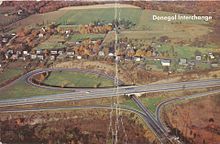
Donegal is a borough in Westmoreland County, Pennsylvania, United States. It is a distinct municipality from the adjacent Donegal Township. The population was 103 at the 2020 census.[3] Donegal is best known as an exit on the Pennsylvania Turnpike with restaurants, gas stations, and two hotels for travelers.
It was named after the town and county of Donegal in Ireland.[4]
- ^ "ArcGIS REST Services Directory". United States Census Bureau. Retrieved October 12, 2022.
- ^ Cite error: The named reference
USCensusDecennial2020CenPopScriptOnlywas invoked but never defined (see the help page). - ^ Bureau, US Census. "City and Town Population Totals: 2020—2021". Census.gov. US Census Bureau. Retrieved July 26, 2022.
{{cite web}}:|last1=has generic name (help) - ^ Gannett, Henry (1905). The Origin of Certain Place Names in the United States. Govt. Print. Off. pp. 107.
