Dorbod Banner
四子王旗 · ᠳᠥᠷᠪᠡᠳ ᠬᠣᠰᠢᠭᠤ Siziwang | |
|---|---|
 | |
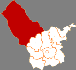
 Dorbod in Ulanqab | |
 Ulanqab in Inner Mongolia | |
| Coordinates: 41°31′59″N 111°42′24″E / 41.53306°N 111.70667°E | |
| Country | China |
| Autonomous region | Inner Mongolia |
| Prefecture-level city | Ulanqab |
| Banner seat | Ulan Hua |
| Area | |
| • Total | 25,513 km2 (9,851 sq mi) |
| Population (2020)[1] | |
| • Total | 129,372 |
| • Density | 5.1/km2 (13/sq mi) |
| Time zone | UTC+8 (China Standard) |
| Website | www |
| Dorbod Banner | |||||||
|---|---|---|---|---|---|---|---|
| Chinese name | |||||||
| Chinese | 四子王旗 | ||||||
| |||||||
| Mongolian name | |||||||
| Mongolian Cyrillic | Дөрвөд хошуу | ||||||
| Mongolian script | ᠳᠥᠷᠪᠡᠳ ᠬᠣᠰᠢᠭᠤ | ||||||
| |||||||
Dorbod Banner or Siziwang Banner (Mongolian: ᠳᠥᠷᠪᠡᠳ ᠬᠣᠰᠢᠭᠤ; Chinese: 四子王旗) is a banner (county equivalent) in Ulanqab, Inner Mongolia, China,[2] bordering Mongolia's Dornogovi Province to the northwest. It is located about 80 km (50 mi) north of Hohhot, the capital of Inner Mongolia.
The banner spans 25,513 square kilometres (9,851 sq mi), and has a population of 129,372 as of 2020.[3] Its seat of government is located in Wulanhua.[4]
- ^ Inner Mongolia: Prefectures, Cities, Districts and Counties
- ^ 2020年统计用区划代码(乌兰察布市) (in Chinese). National Bureau of Statistics of China. 2020. Archived from the original on 2020-12-17. Retrieved 2020-12-17.
- ^ 四子王旗历史沿革. xzqh.org (in Chinese). 2013-04-16. Archived from the original on 2020-12-17. Retrieved 2020-12-17.
- ^ 四子王旗概况地图. xzqh.org (in Chinese). 2013-04-16. Archived from the original on 2020-12-17. Retrieved 2020-12-17.

