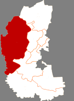
Dorbod County | |
|---|---|
| 杜尔伯特蒙古族自治县 · ᠳᠥᠷᠪᠡᠳ ᠮᠣᠩᠭᠣᠯ ᠥᠪᠡᠷᠲᠡᠭᠡᠨ ᠵᠠᠰᠠᠬᠤ ᠰᠢᠶᠠᠨ Dorbod Mongol Autonomous County | |
 | |
 Dorbod in Daqing | |
 Daqing in Heilongjiang | |
| Coordinates: 46°51′46″N 124°26′33″E / 46.8628°N 124.4426°E | |
| Country | China |
| Province | Heilongjiang |
| Prefecture-level city | Daqing |
| County seat | Dorbod Town (Taikang) |
| Area | |
| • Total | 6,427 km2 (2,481 sq mi) |
| Population (2020 census)[1] | |
| • Total | 199,293 |
| • Density | 31/km2 (80/sq mi) |
| Time zone | UTC+8 (China Standard) |
| Website | www |
| Dorbod Mongol Autonomous County | |||||||
|---|---|---|---|---|---|---|---|
| Chinese name | |||||||
| Simplified Chinese | 杜尔伯特蒙古族自治县 | ||||||
| Traditional Chinese | 杜爾伯特蒙古族自治縣 | ||||||
| |||||||
| Mongolian name | |||||||
| Mongolian Cyrillic | Дөрвөд монгол өөртөө засах шянь | ||||||
| Mongolian script | ᠳᠥᠷᠪᠡᠳ ᠮᠣᠩᠭᠣᠯ ᠥᠪᠡᠷᠲᠡᠭᠡᠨ ᠵᠠᠰᠠᠬᠤ ᠰᠢᠶᠠᠨ | ||||||
| |||||||
Dorbod Mongol Autonomous County (Chinese: 杜尔伯特蒙古族自治县; Mongolian: ᠳᠥᠷᠪᠡᠳ ᠮᠣᠩᠭᠣᠯ ᠥᠪᠡᠷᠲᠡᠭᠡᠨ ᠵᠠᠰᠠᠬᠤ ᠰᠢᠶᠠᠨ) is a county in the west of Heilongjiang province, China, bordering Jilin province to the southwest. It is under the jurisdiction of the prefecture-level city of Daqing. The county is named after the Dörbed Mongols. It was known as Dorbod Banner (杜尔伯特旗) before 1956 and Taikang County (泰康县) during Republican period.
- ^ "2020年大庆市第七次全国人口普查主要数据公报" (in Chinese). Daqing Municipal People's Government. 2021-06-01.