Douchy | |
|---|---|
Part of Douchy-Montcorbon | |
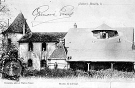
 An old view of the mill in Douchy | |
| Coordinates: 47°56′35″N 3°03′12″E / 47.9431°N 3.0533°E | |
| Country | France |
| Region | Centre-Val de Loire |
| Department | Loiret |
| Arrondissement | Montargis |
| Canton | Courtenay |
| Commune | Douchy-Montcorbon |
| Area 1 | 23.51 km2 (9.08 sq mi) |
| Population (2018)[1] | 910 |
| • Density | 39/km2 (100/sq mi) |
| Demonym | Douchyssois |
| Time zone | UTC+01:00 (CET) |
| • Summer (DST) | UTC+02:00 (CEST) |
| Postal code | 45220 |
| Elevation | 121–190 m (397–623 ft) |
| 1 French Land Register data, which excludes lakes, ponds, glaciers > 1 km2 (0.386 sq mi or 247 acres) and river estuaries. | |
Douchy (French pronunciation: [duʃi]) is a former commune in the Loiret department in north-central France. On 1 January 2016, it was merged into the new commune of Douchy-Montcorbon.[2]


