| Douthat State Park | |
|---|---|
IUCN category V (protected landscape/seascape) | |
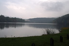
 Douthat Lake in 2006 | |
| Location | Bath / Alleghany counties, Virginia, USA |
| Nearest city | Clifton Forge, Virginia |
| Coordinates | 37°53′51″N 79°48′40″W / 37.89750°N 79.81111°W |
| Area | 4,545 acres (18 km2)[1] |
| Governing body | Virginia Department of Conservation and Recreation |
Douthat State Park Historic District | |
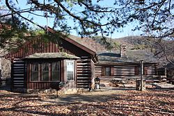
 The lodge at Douthat State Park | |
| Nearest city | Clifton Forge, Virginia |
| Area | 4,493 acres (1,818 ha) |
| Built | 1933 |
| Built by | Civilian Conservation Corps |
| Architectural style | Log cabin style |
| NRHP reference No. | 86002183[2] |
| VLR No. | 008-0136, 134–5088 |
| Significant dates | |
| Added to NRHP | September 20, 1986 |
| Designated VLR | June 17, 1986[3] |
Douthat State Park is a state park located in the Allegheny Mountains in Virginia. It is in Bath County and Alleghany County. The park is 4,545 acres (18 km2)[1] total with a 50-acre (20 ha) lake, making it the third-largest Virginia state park after Pocahontas State Park and Fairy Stone State Park. It is one of the original Virginia state parks built in the 1930s by the Civilian Conservation Corps.
- ^ a b "Douthat State Park".
- ^ "National Register Information System". National Register of Historic Places. National Park Service. July 9, 2010.
- ^ "Virginia Landmarks Register". Virginia Department of Historic Resources. Archived from the original on September 21, 2013. Retrieved May 12, 2013.


