| Dubbo Regional Council New South Wales | |||||||||||||||
|---|---|---|---|---|---|---|---|---|---|---|---|---|---|---|---|
 Civic Administration Building located on Church Street | |||||||||||||||
 Location in New South Wales | |||||||||||||||
| Coordinates | 32°15′S 148°36′E / 32.250°S 148.600°E | ||||||||||||||
| Population | 54,922 (2021 census)[1] | ||||||||||||||
| • Density | 7.2880/km2 (18.8757/sq mi) | ||||||||||||||
| Established | 12 May 2016 | ||||||||||||||
| Area | 7,536 km2 (2,909.7 sq mi)[2] | ||||||||||||||
| Mayor | Josh Black | ||||||||||||||
| Council seat | Dubbo | ||||||||||||||
| Region | |||||||||||||||
| State electorate(s) | |||||||||||||||
| Federal division(s) | |||||||||||||||
 | |||||||||||||||
| Website | Dubbo Regional Council | ||||||||||||||
| |||||||||||||||
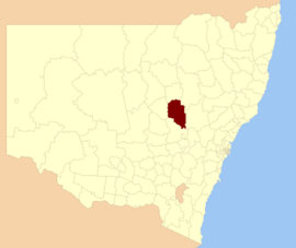
The Dubbo Regional Council is a local government area located in the Central West and Orana regions of New South Wales, Australia. The council was formed on 12 May 2016 through a merger of the City of Dubbo and Wellington Council as part of a widespread council amalgamation program. It was initially named Western Plains Regional Council for almost four months, and its name was changed to Dubbo Regional Council on 7 September 2016.[2]
The council comprises an area of 7,536 square kilometres (2,910 sq mi) and occupies part of the central western plains of New South Wales, surrounding the regional centre of Dubbo. As at the 2016 census, the council had an estimated population of 50,077.[3]
The current mayor of Dubbo Regional Council is Councillor Josh Black.[4]
- ^ Australian Bureau of Statistics (28 June 2022). "Dubbo Regional". 2021 Census QuickStats. Retrieved 6 March 2024.
- ^ a b "Dubbo Regional Council". Stronger Councils. Government of New South Wales. 12 May 2016. Archived from the original on 19 February 2017. Retrieved 7 January 2016.
- ^ Cite error: The named reference
Census2016was invoked but never defined (see the help page). - ^ "Mayor Of Dubbo Regional Council". Dubbo Regional Council. P.O. Box 81 Dubbo NSW 2830. 29 September 2023. Archived from the original on 6 March 2024. Retrieved 6 March 2024.
{{cite web}}: CS1 maint: location (link)