| Dunagiri | |
|---|---|
 Dunagiri from the Kuari Pass | |
| Highest point | |
| Elevation | 7,066 m (23,182 ft) |
| Prominence | c. 1,200 m (3,900 ft)[1] |
| Coordinates | 30°31′57″N 79°50′02″E / 30.53250°N 79.83389°E |
| Geography | |
| Location | Uttarakhand, India |
| Parent range | Nanda Devi Group, Garhwal Himalayas |
| Climbing | |
| First ascent | 5 July 1939 by André Roch, F. Steuri, D. Zogg[2] |
| Easiest route | southwest ridge: rock/snow/ice climb |
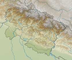
Dunagiri (7,066 m) is one of the high peaks of the Chamoli District Himalayas in the northern Indian state of Uttarakhand. It lies at the northwest corner of the Sanctuary Wall, a ring of peaks surrounding Nanda Devi and enclosing the Nanda Devi Sanctuary.
- ^ This is an approximate figure, based on the 1:150,000 scale topographic map Garhwal-Himalaya-Ost, Swiss Foundation for Alpine Research.
- ^ Jill Neate (1989). High Asia: An Illustrated History of the 7000 Metre Peaks. ISBN 0-89886-238-8.
