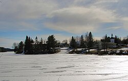
Dunchurch | |
|---|---|
Compact rural community[1] | |
 | |
| Etymology: named after Dunchurch, Warwickshire | |
| Coordinates: 45°38′55″N 79°51′04″W / 45.64861°N 79.85111°W[1] | |
| Country | Canada |
| Province | Ontario |
| Census division | Parry Sound District |
| Municipality | Whitestone |
| First settled | Summer 1870 |
| First named | 1873 |
| Given present name | 1877 |
| Elevation | 258 m (846 ft) |
| Time zone | UTC-5 (Eastern (EST)) |
| • Summer (DST) | UTC-4 (EDT) |
| Postal Code | P0A 1G0[3] |
| Area codes | 705, 249[4] |
Dunchurch is a compact rural community in the Canadian province of Ontario, located in the municipality of Whitestone in Parry Sound District.[1][5][6][7][8]
- ^ a b c "Dunchurch". Geographical Names Data Base. Natural Resources Canada. Retrieved 2021-01-10.
- ^ "Google Earth". Retrieved 2021-01-12.
- ^ "Post Office Locator - Dunchurch, Ontario". Canada Post. Retrieved 2008-06-09.
- ^ "Canadian Area Code Maps". Canadian Numbering Administration Consortium. Retrieved 2021-01-12.
- ^ "Toporama (on-line map and search)". Atlas of Canada. Natural Resources Canada. Retrieved 2021-01-12.
- ^ "Ontario Geonames GIS (on-line map and search)". Ontario Ministry of Natural Resources and Forestry. 2014. Retrieved 2021-01-12.
- ^ Restructured municipalities - Ontario map #4 (Map). Restructuring Maps of Ontario. Ontario Ministry of Municipal Affairs and Housing. 2006. Archived from the original on 2014-04-10. Retrieved 2021-01-12.
- ^ Map 8 (PDF) (Map). 1 : 700,000. Official road map of Ontario. Ministry of Transportation of Ontario. 2020-01-01. Retrieved 2021-01-12.
