Durham-Sud | |
|---|---|
 | |
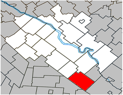
 Location within Drummond RCM | |
| Coordinates: 45°40′N 72°20′W / 45.667°N 72.333°W[1] | |
| Country | Canada |
| Province | Quebec |
| Region | Centre-du-Québec |
| RCM | Drummond |
| Constituted | November 1, 1975 |
| Government | |
| • Mayor | Michel Noël |
| • Federal riding | Drummond |
| • Prov. riding | Johnson |
| Area | |
| • Total | 92.70 km2 (35.79 sq mi) |
| • Land | 93.43 km2 (36.07 sq mi) |
| There is an apparent contradiction between two authoritative sources. | |
| Population (2011)[4] | |
| • Total | 1,008 |
| • Density | 10.8/km2 (28/sq mi) |
| • Pop 2006-2011 | |
| • Dwellings | 420 |
| Time zone | UTC−5 (EST) |
| • Summer (DST) | UTC−4 (EDT) |
| Postal code(s) | |
| Area code | 819 |
| Highways | |
| Website | www |
Durham-Sud, also known as South Durham, is a small farming community in the Eastern Townships of Quebec, west of Richmond and south of Drummondville. The population as of the Canada 2011 Census was 1,008.
- ^ Cite error: The named reference
toponymiewas invoked but never defined (see the help page). - ^ a b Ministère des Affaires municipales, des Régions et de l'Occupation du territoire: Durham-Sud
- ^ Parliament of Canada Federal Riding History: DRUMMOND (Quebec)
- ^ a b 2011 Statistics Canada Census Profile: Durham-Sud, Quebec
