| East Harbor | |
|---|---|
 | |
 Click on the map for a fullscreen view | |
| Location | |
| Country | United States |
| Location | North Truro, Massachusetts |
| Coordinates | 42°03′32″N 70°07′46″W / 42.0589°N 70.1295°W |
| Details | |
| Size | 720 acres (1.13 sq mi; 2.9 km2) |
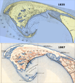
East Harbor is a tidal estuary in Truro, Massachusetts that was originally a natural harbor until it was cut off from Cape Cod Bay to form a salt marsh lagoon, later renamed Pilgrim Lake. It is now within the Cape Cod National Seashore.