| East Ilsley | |
|---|---|
| Village | |
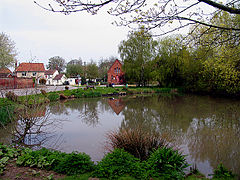
 East Ilsley's village pond and small green with homes | |
Location within Berkshire | |
| Area | 15.02 km2 (5.80 sq mi) |
| Population | 538 (2011 census)[1] |
| • Density | 36/km2 (93/sq mi) |
| OS grid reference | SU4981 |
| Civil parish | |
| Unitary authority | |
| Ceremonial county | |
| Region | |
| Country | England |
| Sovereign state | United Kingdom |
| Post town | Newbury |
| Postcode district | RG20 |
| Dialling code | 01635 |
| Police | Thames Valley |
| Fire | Royal Berkshire |
| Ambulance | South Central |
| UK Parliament | |
| Website | Official website |
East Ilsley is a village and civil parish in the Berkshire Downs in West Berkshire, north of Newbury. The village is centred immediately east of the A34 dual carriageway which passes the length of the village from north to south. It has the vast majority of its buildings in a traditional clustered centre.
- ^ "Key Statistics: Dwellings; Quick Statistics: Population Density; Physical Environment: Land Use Survey 2005". Archived from the original on 11 February 2003. Retrieved 3 December 2014.
