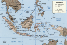
The East Indian Archipelago is an area designated by the International Hydrographic Organization (IHO). It encompasses twelve seas, two gulfs, and one strait in the East Indies (Southeast Asia).[1]
- ^ "Limits of Oceans and Seas, 3rd edition" (PDF). International Hydrographic Organization. 1953. Archived from the original (PDF) on 2016-10-20. Retrieved 2016-02-17.