East Palatka, Florida | |
|---|---|
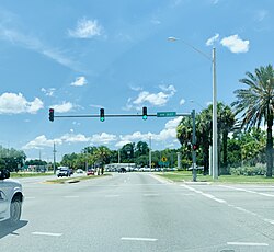
 Intersection of U.S. Route 17/State Road 20/State Road 100 and the southwestern terminus of State Road 207 | |
 Location in Putnam County and the state of Florida | |
| Coordinates: 29°39′0″N 81°35′58″W / 29.65000°N 81.59944°W | |
| Country | |
| State | |
| County | Putnam |
| Area | |
| • Total | 4.71 sq mi (12.20 km2) |
| • Land | 3.18 sq mi (8.24 km2) |
| • Water | 1.53 sq mi (3.97 km2) |
| Elevation | 16 ft (5 m) |
| Population (2020) | |
| • Total | 1,573 |
| • Density | 494.65/sq mi (191.01/km2) |
| Time zone | UTC-5 (Eastern (EST)) |
| • Summer (DST) | UTC-4 (EDT) |
| ZIP code | 32131 |
| Area code | 386 |
| FIPS code | 12-19350[2] |
| GNIS feature ID | 0282007[3] |
East Palatka is a census-designated place (CDP) in Putnam County, Florida, United States. It is located on the east side of the City of Palatka at the intersection of U.S. Route 17/State Road 20/State Road 100 and the southwestern terminus of State Road 207. The population was 1,573 at the 2020 census, down from 1,654 at the 2010 census.[4] It is part of the Palatka, Florida Micropolitan Statistical Area.
East Palatka is home to the Palatka State Farmer's Market, as well as the Putnam County Fairgrounds.
- ^ "2020 U.S. Gazetteer Files". United States Census Bureau. Retrieved October 31, 2021.
- ^ "U.S. Census website". United States Census Bureau. Retrieved January 31, 2008.
- ^ "US Board on Geographic Names". United States Geological Survey. October 25, 2007. Retrieved January 31, 2008.
- ^ Florida 2010 census data for places Archived 2016-01-23 at the Wayback Machine. Retrieved 2011-04-26.