This article needs additional citations for verification. (September 2014) |
Eastern Development Region
Purwānchal Bikās Kshetra | |
|---|---|
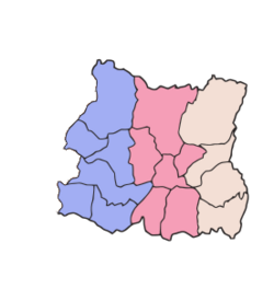
 Location of EDR | |
 | |
| Country | |
| Established | 1972 |
| Disestablished | 2015 |
| Founded by | King Mahendra |
| Headquarters | Dhankuta, Kosi Zone |
| Largest city | Biratnagar |
| Zones | List
|
| Government | |
| • Type | Regional Administration |
| • Body | Eastern Development Regional Administration |
| Area | |
| • Total | 28,456 km2 (10,987 sq mi) |
| Highest elevation | 8,848 m (29,029 ft) |
| Lowest elevation | 59 m (194 ft) |
| Population (2011 Census) | |
| • Total | 5,811,555 |
| pop. note | |
| Demonym | Purbeli |
| Time zone | UTC+5:45 (NPT) |
| Official language | Nepali |
The Eastern Development Region (Nepali: पुर्वाञ्चल विकास क्षेत्र, Purwānchal Bikās Kshetra) was one of Nepal's five development regions. It is also known as Kirata region.[1] It was located at the eastern end of the country with its headquarters at Dhankuta. The town of Dhankuta was the headquarter of the Eastern Region, as well as the headquarter of the Dhankuta District.[2][3]
- ^ P.2,3 Gorkhaland Movement: A Study in Ethnic Separatism By Amiya K. Samanta APH Publishing, 2000 Darjeeling
- ^ "Eastern Development Region". myholidaynepal.com. Retrieved 14 February 2018.
- ^ "1. Eastern Development Region". khullakitab.com. Archived from the original on 16 September 2019. Retrieved 14 February 2018.