Echols County | |
|---|---|
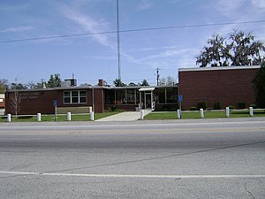
 Echols County Courthouse in Statenville | |
 Location within the U.S. state of Georgia | |
 Georgia's location within the U.S. | |
| Coordinates: 30°43′N 82°54′W / 30.72°N 82.9°W | |
| Country | |
| State | |
| Founded | December 13, 1858 |
| Named for | Robert Milner Echols |
| Seat | Statenville |
| Largest community | Statenville |
| Area | |
• Total | 421 sq mi (1,090 km2) |
| • Land | 415 sq mi (1,070 km2) |
| • Water | 5.8 sq mi (15 km2) 1.4% |
| Population (2020) | |
• Total | 3,697 |
| • Density | 9/sq mi (3/km2) |
| Time zone | UTC−5 (Eastern) |
| • Summer (DST) | UTC−4 (EDT) |
| Congressional district | 1st |
| Website | echolscountyga |
Echols County (/ˈɛkəlz/) is a county located in the southeastern part of the U.S. state of Georgia. As of the 2020 census, the population was 3,697. The county seat is Statenville.[1] Since 2008,[2] Statenville is a disincorporated municipality. Echols and Webster counties are the only two counties in Georgia to currently have no incorporated municipalities. The county was established in 1858 and named in honor of Robert Milner Echols[3] (1798–1847).
Echols County is part of the Valdosta, GA metropolitan statistical area.
- ^ "Find a County". National Association of Counties. Archived from the original on July 12, 2012. Retrieved June 7, 2011.
- ^ "QA on the News: Are there any non-partisan commissions in Georgia?". The Atlanta Constitution. November 23, 2010 – via Newspapers.com.
- ^ Gannett, Henry (1905). The Origin of Certain Place Names in the United States. Govt. Print. Off. pp. 113.
