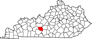
Edmonson County | |
|---|---|
 Edmonson County Courthouse in Brownsville | |
 Location within the U.S. state of Kentucky | |
 Kentucky's location within the U.S. | |
| Coordinates: 37°13′N 86°15′W / 37.21°N 86.25°W | |
| Country | |
| State | |
| Founded | January 12, 1825 |
| Named for | John Edmonson |
| Seat | Brownsville |
| Largest city | Brownsville |
| Area | |
| • Total | 308 sq mi (800 km2) |
| • Land | 303 sq mi (780 km2) |
| • Water | 5.1 sq mi (13 km2) 1.7% |
| Population (2020) | |
| • Total | 12,126 |
| • Estimate (2023) | 12,448
|
| • Density | 39/sq mi (15/km2) |
| Time zone | UTC−6 (Central) |
| • Summer (DST) | UTC−5 (CDT) |
| Congressional district | 2nd |
| Website | www |
Edmonson County is a county located in the south central portion of the U.S. state of Kentucky. As of the 2020 census, the population was 12,126.[1] Its county seat and only municipality is Brownsville.[2] The county was formed in 1825 and named for Captain John "Jack" Edmonson (1764–1813), who was killed at the Battle of Frenchtown during the War of 1812.[3][4][5][6] This is a dry county where the sale of alcohol is prohibited. Edmonson County is included in the Bowling Green, Kentucky Metropolitan Statistical Area.
- ^ "Census - Geography Profile: Edmonson County, Kentucky". United States Census Bureau. Retrieved December 30, 2022.
- ^ "Find a County". National Association of Counties. Archived from the original on July 12, 2012. Retrieved June 7, 2011.
- ^ "Edmonson County". The Kentucky Encyclopedia. 2000. Archived from the original on July 17, 2019. Retrieved August 21, 2014.
- ^ Rennick, Robert M. (1987). Kentucky Place Names. University Press of Kentucky. p. 89. ISBN 0813126312. Retrieved April 28, 2013.
- ^ The Register of the Kentucky State Historical Society, Volume 1. Kentucky State Historical Society. 1903. pp. 35.
- ^ Gannett, Henry (1905). The Origin of Certain Place Names in the United States. Govt. Print. Off. pp. 115.
