Ein al-Zeitun
عين الزيتون Ayn az-Zaytun | |
|---|---|
Village | |
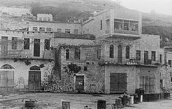
 Ein al-Zeitun, 1948 | |
| Etymology: "spring of olives"[1] | |
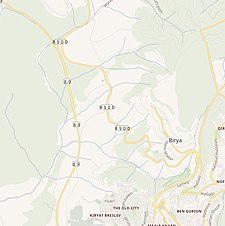
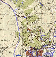
A series of historical maps of the area around Ein al-Zeitun (click the buttons) | |
Location within Mandatory Palestine | |
| Coordinates: 32°58′51″N 35°29′30″E / 32.98083°N 35.49167°E | |
| Palestine grid | 196/265 |
| Geopolitical entity | Mandatory Palestine |
| Subdistrict | Safad |
| Date of depopulation | May 2, 1948[4] |
| Area | |
| • Total | 1,100 dunams (1.1 km2 or 300 acres) |
| Population (1945) | |
| • Total | 820[2][3] |
| Cause(s) of depopulation | Military assault by Yishuv forces |
| Current Localities | None |
Ein al-Zeitun[a], was a Palestinian Arab village, located 1.5 kilometres (0.93 mi) north of Safed in the Upper Galilee. During the early Ottoman period, Ein el-Zeitun had a mixed population of Muslims and Jews. Later, in the 19th century, it became entirely Muslim. The village's small population and land area as well as its proximity to Safad made it a suburb of the city. In 1945, the village had a population of 820 inhabitants and a total land area of 1,100 dunams.[3] The village was depopulated in 1948, after the Ein al-Zeitun massacre.
Cite error: There are <ref group=lower-alpha> tags or {{efn}} templates on this page, but the references will not show without a {{reflist|group=lower-alpha}} template or {{notelist}} template (see the help page).


