El Dorado County | |
|---|---|
|
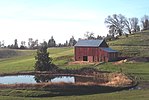
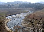
Images, from top down, left to right: A barn in El Dorado County, the shore of Lake Tahoe in Ed Z'berg Sugar Pine Point State Park, the South Fork American River running through the El Dorado hills, Marshall Gold Discovery State Historic Park | |
 Interactive map of El Dorado County | |
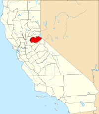
 Location in the state of California | |
| Country | United States |
| State | California |
| Regions | Northern California, Sierra Nevada, Gold Country |
| Metropolitan area | Greater Sacramento |
| Incorporated | February 18, 1850[1] |
| Named for | Spanish for "the golden" and El Dorado |
| County seat | Placerville |
| Largest community | El Dorado Hills |
| Government | |
| • Type | Council–CAO |
| • Body | Board of Supervisors[2]
|
| • Chair | Lori Parlin |
| • Vice Chair | Wendy Thomas |
| • Chief Administrative Office[3] | Don Ashton |
| Area | |
| • Total | 1,786 sq mi (4,630 km2) |
| • Land | 1,708 sq mi (4,420 km2) |
| • Water | 78 sq mi (200 km2) |
| Highest elevation | 10,886 ft (3,318 m) |
| Population (2020) | |
| • Total | 191,185 |
| • Estimate (2023) | 192,215 |
| • Density | 110/sq mi (41/km2) |
| Time zone | UTC−8 (Pacific Time Zone) |
| • Summer (DST) | UTC−7 (Pacific Daylight Time) |
| ZIP code | 95762 |
| Area code | 530, 916, 279 |
| FIPS code | 06-017 |
| GNIS feature ID | 277273 |
| Congressional districts | 3rd, 5th |
| Website | www.edcgov.us |
El Dorado County (/ˌɛl dəˈrɑːdoʊ/ ; El Dorado, Spanish for "The Golden [one]"), officially the County of El Dorado, is a county located in the U.S. state of California. As of the 2020 census, the population was 191,185.[5] The county seat is Placerville.[6] The county is part of the Sacramento-Roseville-Arden-Arcade, CA Metropolitan Statistical Area. It is located entirely in the Sierra Nevada, from the historic Gold Country in the western foothills to the High Sierra in the east. El Dorado County's population has grown as Greater Sacramento has expanded into the region. Where the county line crosses US 50 at Clarksville, the distance to Sacramento is 15 miles (24 km). In the county's high altitude eastern end at Lake Tahoe, environmental awareness and environmental protection initiatives have grown along with the population since the 1960 Winter Olympics, hosted at the former Squaw Valley Ski Resort in neighboring Placer County.
- ^ "Chronology". California State Association of Counties. Archived from the original on January 29, 2016. Retrieved February 6, 2015.
- ^ "Board of Supervisors - El Dorado County".
- ^ "Chief Administrative Office - El Dorado County".
- ^ "Freel Peak". Peakbagger.com. Retrieved February 6, 2015.
- ^ "El Dorado County, California". United States Census Bureau. Retrieved January 30, 2022.
- ^ "Find a County". National Association of Counties. Archived from the original on July 12, 2012. Retrieved June 7, 2011.


