26°06′14″N 34°16′52″E / 26.10389°N 34.28111°E
El Qoseir
القصير (Arabic) | |
|---|---|
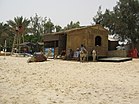
Clockwise from top: View of the sea, Under the sea, road from Al-Qusair to Safaga, Flag on beach, Camels for rides on the beach | |
| Coordinates: 26°06′14″N 34°16′52″E / 26.10389°N 34.28111°E | |
| Country | |
| Governorate | Red Sea |
| Time zone | UTC+2 (EST) |

El Qoseir[note 1] (Arabic: القصير, romanized: el-Qoṣēr, pronounced [elʔoˈsˤeːɾ]) is a city in eastern Egypt, located on the Red Sea west coast. Populated for approximately 5,000 years, its ancient Egyptian name was Tjau,[1] while its ancient Greek name during the Ptolemaic era was Myos Hormos.[2] Historically, it was the endpoint of the Wadi Hammamat trail, an important route connecting Egypt and the Red Sea. El Qoseir is located 138 kilometers south of Hurghada, 130 km north of Marsa Alam and 68 km north of the Marsa Alam International Airport. In 1986, its population was approximately 20,000. Today, the population of El Qoseir is around 50,000.
Cite error: There are <ref group=note> tags on this page, but the references will not show without a {{reflist|group=note}} template (see the help page).
- ^ Hannig, Rainer (2009). Grosses Handwörterbuch Ägyptisch-Deutsch: die Sprache der Pharaonen (2800 - 950 v. Chr.). HL (5. unverändert. Aufl., Marburger ed.). Mainz: von Zabern. ISBN 978-3-8053-1771-9.
- ^ Myos Hormos - Quseir al-Qadim: Roman and Islamic Ports on the Red Sea, Blue, Lucie, Peacock, David P. S.,Oxbow (2006)


