Elberta, Alabama | |
|---|---|
 St. Mark's Lutheran Church (Elberta, Alabama) | |
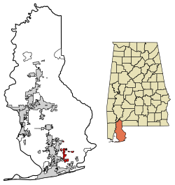
 Location of Elberta in Baldwin County, Alabama. | |
| Coordinates: 30°24′52″N 87°35′52″W / 30.41444°N 87.59778°W[1] | |
| Country | United States |
| State | Alabama |
| County | Baldwin |
| Area | |
| • Total | 7.08 sq mi (18.33 km2) |
| • Land | 6.98 sq mi (18.07 km2) |
| • Water | 0.10 sq mi (0.26 km2) |
| Elevation | 66 ft (20 m) |
| Population (2020) | |
| • Total | 1,974 |
| • Density | 282.93/sq mi (109.24/km2) |
| Time zone | UTC-6 (Central (CST)) |
| • Summer (DST) | UTC-5 (CDT) |
| ZIP code | 36530 |
| Area code | 251 |
| FIPS code | 01-23320 |
| GNIS feature ID | 0117910 [1] |
| Website | townofelberta |
Elberta is a town in Baldwin County, Alabama, United States. At the 2010 census the population was 1,498,[3] up from 552 at the 2000 census. It is part of the Daphne-Fairhope-Foley metropolitan area.
- ^ a b c U.S. Geological Survey Geographic Names Information System: Elberta, Alabama
- ^ "2020 U.S. Gazetteer Files". United States Census Bureau. Retrieved October 29, 2021.
- ^ "Geographic Identifiers: 2010 Demographic Profile Data (G001): Elberta town, Alabama". U.S. Census Bureau, American Factfinder. Archived from the original on February 12, 2020. Retrieved September 13, 2013.
