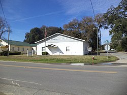
Ellenton, Georgia | |
|---|---|
 Ellenton City Hall | |
 Location in Colquitt County and the state of Georgia | |
| Coordinates: 31°10′36″N 83°35′17″W / 31.17667°N 83.58806°W | |
| Country | United States |
| State | Georgia |
| County | Colquitt |
| Area | |
| • Total | 0.80 sq mi (2.06 km2) |
| • Land | 0.79 sq mi (2.05 km2) |
| • Water | 0.00 sq mi (0.01 km2) |
| Elevation | 259 ft (79 m) |
| Population (2020) | |
| • Total | 210 |
| • Density | 265.49/sq mi (102.50/km2) |
| Time zone | UTC-5 (Eastern (EST)) |
| • Summer (DST) | UTC-4 (EDT) |
| ZIP code | 31747 |
| Area code | 229 |
| FIPS code | 13-27008[2] |
| GNIS feature ID | 0331648[3] |
| Website | http://www.ellentonga.com/ |
Ellenton is a town in Colquitt County, Georgia, United States. Its population was 281 at the 2010 census.[4] It was incorporated in 1970 by the Georgia General Assembly.[5] It is located at 31°10′36″N 83°35′17″W / 31.17667°N 83.58806°W (31.176563, -83.588016).[6]
According to the United States Census Bureau, it has an area of 0.8 square miles (2.1 km2), all land.
- ^ "2020 U.S. Gazetteer Files". United States Census Bureau. Retrieved December 18, 2021.
- ^ "U.S. Census website". United States Census Bureau. Retrieved January 31, 2008.
- ^ "US Board on Geographic Names". United States Geological Survey. October 25, 2007. Retrieved January 31, 2008.
- ^ "Profile of General Population and Housing Characteristics: 2010 Demographic Profile Data (DP-1): Ellenton town, Georgia". United States Census Bureau. Retrieved February 1, 2012.
- ^ "Ellenton". GeorgiaGov. Retrieved July 1, 2019.
- ^ "US Gazetteer files: 2010, 2000, and 1990". United States Census Bureau. February 12, 2011. Retrieved April 23, 2011.