𒂍𒈥 | |
 View from the Byzantine Tower at Meskene, ancient Barbalissos | |
| Alternative name | Tell Meskene (Arabic: تل مسكنة) |
|---|---|
| Location | Near Maskanah, Aleppo Governorate, Syria |
| Region | Lake Assad shoreline |
| Coordinates | 35°59′12.63″N 38°6′40.95″E / 35.9868417°N 38.1113750°E |
| Type | settlement |
| History | |
| Abandoned | 1187 BC |
| Cultures | Amorite |
| Satellite of | Ebla, Yamhad, Carchemish |
| Site notes | |
| Excavation dates | 1972–1976 1996–2002 |
| Archaeologists | Jean-Claude Margueron |
| Ownership | Public |
| Public access | Yes |
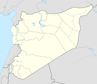
Emar (Akkadian: 𒂍𒈥, É-mar),[1] is an archaeological site at Tell Meskene in the Aleppo Governorate of northern Syria. It sits in the great bend of the mid-Euphrates, now on the shoreline of the man-made Lake Assad near the town of Maskanah.
It has been the source of many cuneiform tablets, making it rank with Ugarit, Mari and Ebla among the most important archaeological sites of Syria. In these texts, dating from the 14th century BC to the fall of Emar in 1187 BC,[2] and in excavations in several campaigns since the 1970s, Emar emerges as an important Bronze Age trade center, occupying a liminal position between the power centers of Upper Mesopotamia and Anatolia–Syria. Unlike other cities, the tablets preserved at Emar, most of them in Akkadian and of the thirteenth century BC, are not royal or official, but record private transactions, judicial records, dealings in real estate, marriages, last wills, formal adoptions. In the house of a priest, a library contained literary and lexical texts in the Mesopotamian tradition, and ritual texts for local cults. The area of Emar was fortified by the Romans, Byzantines, and medieval Arabs as Barbalissos or Balis but that location is slightly removed from the more ancient tell and is dealt with in its separate article.
- ^ Westenholz, Joan (2000). Cuniform Inscriptions in the Collection of the Bible Lands Museum Jerusalem: The Emar Tabltes. Styx. pp. 121, 129.
- ^ Jean-Claude Margueron and Veronica Boutte, "Emar, Capital of Aštata in the Fourteenth Century BCE" The Biblical Archaeologist 58.3 (September 1995:126-138); a single Old Babylonian tablet was recovered.
