| Emigrant Wilderness | |
|---|---|
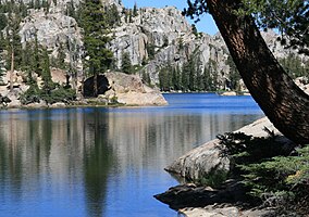
 Lake Lertora, Emigrant Wilderness | |
| Location | Tuolumne County, California, United States |
| Nearest city | Merced, CA |
| Coordinates | 38°11′07″N 119°45′53″W / 38.18528°N 119.76472°W |
| Area | 112,277 acres (454.37 km2) |
| Established | January 1, 1974 |
| Governing body | U.S. Forest Service |

The Emigrant Wilderness of Stanislaus National Forest is a formally designated wilderness area in the Sierra Nevada. It is bordered by Yosemite National Park on the south, the Toiyabe National Forest and the Hoover Wilderness on the east, and State Route 108 over Sonora Pass on the north. It is an elongated area that extends northeast about 25 miles (40 km) in length and up to 15 miles (24 km) in width. Watersheds drain to the Stanislaus and Tuolumne Rivers. The Emigrant Wilderness area, which is a glaciated landscape, is entirely within Tuolumne County, California and is approximately 140 miles (230 km) east of San Francisco, California and 50 miles (80 km) south of Lake Tahoe.[1]
The northeastern third of the Wilderness is dominated by volcanic ridges and peaks; the remaining areas consist of many sparsely vegetated, granitic ridges interspersed with numerous lakes and meadows. Elevations range from below 5,000 feet (1,500 m) near Cherry Reservoir to 11,570 feet (3,527 m) at Leavitt Peak, but the elevation range of most of the popular areas is 7,500 to 9,000 feet (2,300 to 2,700 m). Precipitation averages 50 inches (1,300 mm) annually, 80% of it in the form of snow. Snowpacks typically linger into June, sometimes later following very wet winters. Summers are generally dry and mild, but afternoon thundershowers occur periodically and nighttime temperatures could dip below freezing anytime.[1]
- ^ a b
 This article incorporates public domain material from Emigrant Wilderness. United States Department of Agriculture.

