Encanto, San Diego | |
|---|---|
| Encanto | |
 View of Encanto from atop 61st Street, O'Farrell | |
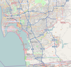
 Encanto is located in the southeastern area of the city of San Diego | |
| Coordinates: 32°42′45″N 117°03′40″W / 32.71250°N 117.06111°W | |
| Country | |
| State | |
| County | |
| City | |
| ZIP Code | 92114 |
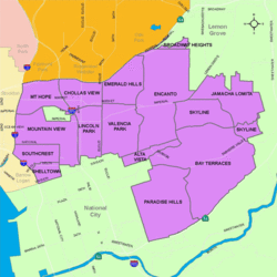
Encanto (Spanish for "Charm") is a hilly urban neighborhood located in the southeastern region of San Diego, California. The neighborhood is bordered by California State Route 94 and the communities of Oak Park and Broadway Heights to the north, O'Farrell (also known as South Encanto) to the south, Emerald Hills and Valencia Park to the west and the City of Lemon Grove to the east.
