| Endeavour Endeavours | |
|---|---|
 Endeavour River at Marton, 2004 | |
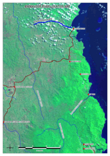
 Satellite image of the Endeavour River course marked in dark blue | |
| Etymology | HMS Endeavour[1] |
| Native name | Wabalumbaal (Guugu Yimidhirr) |
| Location | |
| Country | Australia |
| State | Queensland |
| Region | Far North Queensland |
| Physical characteristics | |
| Source | Endeavour River Right Branch |
| • location | northwest of Hopevale |
| • coordinates | 15°15′17″S 145°03′01″E / 15.25472°S 145.05028°E |
| • elevation | 327 m (1,073 ft) |
| 2nd source | Endeavour River North Branch |
| • location | below Honeysuckle Flat |
| • coordinates | 15°20′50″S 145°06′11″E / 15.34722°S 145.10306°E |
| • elevation | 160 m (520 ft) |
| 3rd source | Endeavour River South Branch |
| • location | near Alderbury |
| • coordinates | 15°25′25″S 144°54′54″E / 15.42361°S 144.91500°E |
| • elevation | 109 m (358 ft) |
| Source confluence | Right Branch to from the Endeavour River |
| • location | Endeavour River National Park |
| • coordinates | 15°26′34″S 145°12′12″E / 15.44278°S 145.20333°E |
| Mouth | Coral Sea |
• location | Cooktown |
• coordinates | 15°27′23″S 145°14′59″E / 15.45639°S 145.24972°E |
• elevation | 0 m (0 ft) |
| Length | 140 km (87 mi) |
| Basin size | 1,315 km2 (508 sq mi) to 958.6 km2 (370.1 sq mi)[2] |
| Discharge | |
| • location | Near mouth |
| • average | 24 m3/s (760 GL/a)[2] |
| Basin features | |
| National park | Endeavour River National Park |
| [3][4][5][6] | |
The Endeavour River (Guugu Yimithirr: Wabalumbaal), inclusive of the Endeavour River Right Branch, the Endeavour River South Branch, and the Endeavour River North Branch, is a river system located on Cape York Peninsula in Far North Queensland, Australia.
- ^ Cite error: The named reference
shaywas invoked but never defined (see the help page). - ^ a b "East Coastal Watersheds".
- ^ "Map of Endeavour River, QLD". Bonzle Digital Atlas of Australia. Retrieved 27 October 2015.
- ^ "Map of Endeavour River Right Branch, QLD". Bonzle Digital Atlas of Australia. Retrieved 27 October 2015.
- ^ "Map of Endeavour River South Branch, QLD". Bonzle Digital Atlas of Australia. Retrieved 27 October 2015.
- ^ "Map of Endeavour River North Branch, QLD". Bonzle Digital Atlas of Australia. Retrieved 27 October 2015.