This article needs additional citations for verification. (August 2013) |
Engaru
遠軽町 | |
|---|---|
Town | |
 The town view from Gambōiwa | |
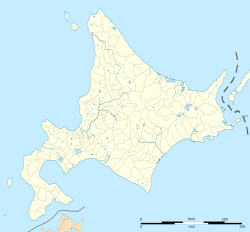
 Location of Engaru in Hokkaido (Okhotsk Subprefecture) | |
| Coordinates: 44°4′N 143°32′E / 44.067°N 143.533°E | |
| Country | Japan |
| Region | Hokkaido |
| Prefecture | Hokkaido (Okhotsk Subprefecture) |
| District | Mombetsu |
| Area | |
| • Total | 1,332.32 km2 (514.41 sq mi) |
| Population (September 30, 2016) | |
| • Total | 20,757 |
| • Density | 16/km2 (40/sq mi) |
| Time zone | UTC+09:00 (JST) |
| City hall address | 1-1 1 Jō-Kita 3chōme, Engaru-chō, Hokkaido 099-0403 |
| Climate | Dfb |
| Website | engaru |
| Symbols | |
| Flower | Sunflower |
| Tree | Sargent's cherry |
Engaru (遠軽町, Engaru-chō) is a town in the Okhotsk subprefecture of Hokkaido, Japan. The name comes from the Ainu place name Inkar-us-i ("overlook-always doing-place"), meaning a lookout point.[1][2]
On October 1, 2005, the towns of Ikutahara and Maruseppu, and the village of Shirataki, all from Monbetsu District merged into the expanded town of Engaru.[3] As of September 2016, the town has an estimated population of 20,757.[4] The total area is 1,332.32 square kilometres (514.41 sq mi),[5] making it the fifth largest municipality in Hokkaido.[6]
Engaru is known as the place where Aikido originated, in the Shirataki area.[7] It is also where the largest cosmos flower park in Japan is located. An Upper Paleolithic site at Shirataki Site Group is the source of some Yubetsu technique stone blades dating from approximately 13,000 years ago.
- ^ "瞰望岩(がんぼういわ)" Archived 2016-12-21 at the Wayback Machine Engaru Town Hall
- ^ Cite error: The named reference
ochoshiciwas invoked but never defined (see the help page). - ^ "遠軽町の沿革" Archived 2015-08-25 at the Wayback Machine Engaru Town Hall
- ^ "人口・世帯・動態(平成25年度)" Archived 2017-02-07 at the Wayback Machine Engaru Town Hall
- ^ "位置・面積" Archived 2019-04-27 at the Wayback Machine Engaru Town Hall
- ^ "全国都道府県市区町村別面積調" Archived 2013-01-22 at the Wayback Machine Geospatial Information Authority of Japan, 2011
- ^ "合気道開祖・植芝盛平翁(Aikido Founder・Morihei Ueshiba)" Archived 2013-06-13 at the Wayback Machine Tanabe City Hall


