English Avenue and Vine City | |
|---|---|
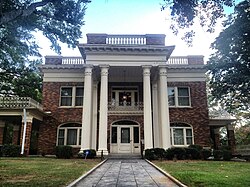
 Herndon Home, built by African-American insurance magnate Alonzo Herndon | |
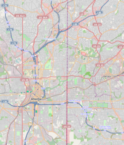
Location in Central Atlanta | |
| Coordinates: 33°45′48″N 84°24′37″W / 33.763441°N 84.410341°W | |
| Country | United States |
| State | Georgia |
| County | Fulton |
| Government | |
| • Type | Neighborhoods of Atlanta |
| Time zone | UTC-5 (Eastern (EST)) |
| • Summer (DST) | UTC-4 (EDT) |


English Avenue and Vine City are two adjacent and closely linked neighborhoods of Atlanta, Georgia. Together the neighborhoods make up neighborhood planning unit L.[1] The two neighborhoods are frequently cited together in reference to shared problems and to shared redevelopment schemes and revitalization plans.[2][3][4][5]
English Avenue is bounded by the railroad line and the Marietta Street Artery neighborhood to the northeast, Northside Drive, the North Avenue railyards and downtown Atlanta to the east, Joseph E. Lowery Blvd. (formerly Ashby St.) and the Bankhead neighborhood to the west, and Joseph E. Boone Blvd. (called Simpson St. until 2008) and Vine City to the south. Its population was 3,309 in 2010.[6]
Vine City is bounded by Joseph E. Boone Blvd. (Simpson) and the English Avenue neighborhood to the north, Northside Drive and downtown Atlanta to the east, Martin Luther King Jr. Dr. (formerly Hunter St.) and the Atlanta University Center to the south, and Joseph E. Lowery Blvd. (Ashby) and the Washington Park neighborhood to the west. Its population was 2,785 in 2010.[6]
A section of the area, "The Bluff," is infamous throughout Metro Atlanta as a high crime area, but in late 2011, English Avenue and Vine City were the focus of multiple improvement plans, including a network of parks and trails,[2][7] increased police presence, and "rebranding" for a more positive image.[8][9][10] Construction is to start on the new Rodney Cook Sr. Park.
- ^ "City of Atlanta, NPU L Map" (PDF). 174.37.215.145. Retrieved April 16, 2018.[permanent dead link]
- ^ a b Thomas Wheatley, "Ambitious parks plans could give Vine City, English Avenue another chance", Creative Loafing, December 8, 2011
- ^ "grants to the Vine City and English Avenue communities" in "Vine City targeted for revitalization", Atlanta Journal-Constitution, October 23, 2010
- ^ ""Vine City/English Avenue Trust Fund", Invest Atlanta". Investatlanta.com. Archived from the original on 11 February 2012. Retrieved 16 April 2018.
- ^ "The Vine City and English Avenue neighborhoods have voiced their support" in Sunset Avenue Historic District Archived 2012-04-25 at the Wayback Machine
- ^ a b 2010 U.S. census figures as tabulated by WalkScore
- ^ ""Proctor Creek North Avenue Watershed basin", Park Pride" (PDF). Archived from the original (PDF) on April 20, 2012. Retrieved December 12, 2011.
- ^ "The Bluff: Atlanta's forgotten neighborhood", 11 Alive News (Atlanta)[permanent dead link]
- ^ ""Re-branding The Bluff and English Avenue in the ATL', 11 Alive News (Atlanta), December 22, 2011". Archived from the original on January 16, 2013. Retrieved February 21, 2012.
- ^ ""Return to The Bluff: Not Forgotten any longer", 11 Alive News (Atlanta), December 19, 2011". Archived from the original on January 15, 2013. Retrieved February 21, 2012.
