| UNESCO World Heritage Site | |
|---|---|
 Camels at a waterhole in a canyon in Ennedi | |
| Location | Ennedi Region, Chad |
| Criteria | Cultural and Natural: (iii), (vii), (ix) |
| Reference | 1475 |
| Inscription | 2016 (40th Session) |
| Area | 2,441,200 ha (6,032,000 acres) |
| Buffer zone | 777,800 ha (1,922,000 acres) |
| Coordinates | 17°2′30″N 21°51′46″E / 17.04167°N 21.86278°E |

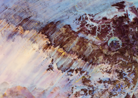
The Ennedi Plateau is located in the northeast of Chad, in the regions of Ennedi-Ouest and Ennedi-Est. It is considered a part of the group of mountains known as the Ennedi Massif found in Chad, which is one of the nine countries that make up the Sahelian belt that spans the Atlantic Ocean to Sudan. The Ennedi is a sandstone bulwark in the middle of the Sahara, which was formed by erosion from wind and temperature.[1] Many people occupied this area, such as hunters-gatherers (5,000-4,000 cal BC) and pastoralists (beginning 4,000 cal BC). The Ennedi area is also known for its large collection of rock art depicting mainly cattle, as these animals had the greatest financial, environmental, and cultural impact. This art dates back nearly 7,000 years ago.[2] Today, two semi-nomadic groups, mainly Muslim, live in the Ennedi during the rainy months and pass through the area during the dry season. They rely on their herds of camels, donkeys, sheep, and goats to survive.[3]
- ^ "Niola Doa". africanrockart.britishmuseum.org. Retrieved 2019-11-01.
- ^ Cite error: The named reference
africanparks.orgwas invoked but never defined (see the help page). - ^ "region | Definition, Examples, & Facts". Encyclopedia Britannica. Retrieved 2019-11-24.
