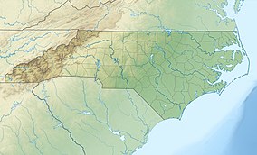
| Eno River State Park | |
|---|---|
 Eno Park Footbridge | |
| Location | North Carolina, United States |
| Coordinates | 36°3′24″N 78°58′52″W / 36.05667°N 78.98111°W |
| Area | 4,319 acres (17.48 km2)[1] |
| Established | 1975 |
| Named for | Eno River |
| Governing body | North Carolina Division of Parks and Recreation |
| Website | Eno River State Park |
Eno River State Park is a 4,319-acre (17.48 km2)[1] North Carolina state park in Durham and Orange Counties, North Carolina. Together with the adjoining West Point on the Eno city park, the two parks preserve over 14 miles (22.5 km) of the Eno River and surrounding lands.
There are five public access areas with features including twenty-four miles of hiking trails, canoe launches, picnic areas, and historic structures.


