| Eola Hills | |
|---|---|
 Eola Hills | |
| Highest point | |
| Elevation | 1,170 ft (360 m)[1] |
| Geography | |
| Country | United States |
| State | Oregon |
| County | Yamhill County |
| Range coordinates | 45°4′31.425″N 123°7′25.362″W / 45.07539583°N 123.12371167°W |
| Topo map | USGS Mission Bottom |
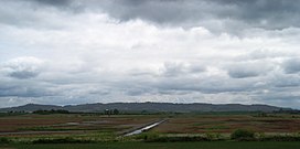
The Eola Hills are a range of hills northwest of Salem, Oregon, United States.[2] They stretch from the community of Eola about 10 miles (16 km) north to Yamhill County.
They are divided from the Salem Hills by the Willamette River at Eola.
- ^ "Eola Hills". ListsOfJohn.com. Retrieved 2012-11-18.
- ^ a b "Eola Hills". Geographic Names Information System. United States Geological Survey, United States Department of the Interior.
