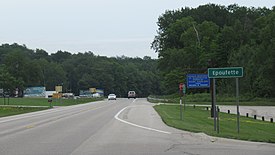
Epoufette, Michigan | |
|---|---|
 Signage looking east along U.S. Route 2 | |
| Coordinates: 46°03′20″N 85°10′06″W / 46.05556°N 85.16833°W | |
| Country | United States |
| State | Michigan |
| County | Mackinac |
| Township | Hendricks |
| Settled | 1848 |
| Established | 1881 |
| Elevation | 591 ft (180 m) |
| Time zone | UTC-5 (Eastern (EST)) |
| • Summer (DST) | UTC-4 (EDT) |
| ZIP code(s) | 49762 (Naubinway) |
| Area code | 906 |
| GNIS feature ID | 625620[1] |
| Epoufette Informational Designation | |
|---|---|
 | |
| Location | Roadside Park, U.S. Route 2 Naubinway, Michigan |
| Coordinates | 46°03′25″N 85°09′48″W / 46.0569131°N 85.1633119°W |
| Designated | July 23, 1985 |
Epoufette (/iːpoʊˈfɛt/ EE-poh-feht) is an unincorporated community in Mackinac County in the U.S. state of Michigan.[1] The community is located along the northern shores of Lake Michigan along U.S. Route 2 within Hendricks Township. As an unincorporated community, Epoufette has no legally defined boundaries or population statistics of its own.

