Erie | |
|---|---|
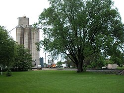
 Grain elevator and the BNSF Railway in Erie. | |
 Location of Erie in Whiteside County, Illinois. | |
 Location of Illinois in the United States | |
| Coordinates: 41°39′28″N 90°4′44″W / 41.65778°N 90.07889°W | |
| Country | United States |
| State | Illinois |
| County | Whiteside |
| Area | |
| • Total | 1.39 sq mi (3.60 km2) |
| • Land | 1.38 sq mi (3.58 km2) |
| • Water | 0.01 sq mi (0.03 km2) |
| Population (2020) | |
| • Total | 1,518 |
| • Density | 1,100.00/sq mi (424.57/km2) |
| Time zone | UTC-6 (CST) |
| • Summer (DST) | UTC-5 (CDT) |
| ZIP Code(s) | 61250 |
| Area code | 309 |
| FIPS code | 17-24374 |
| GNIS ID | 2398840 |
| Website | www |
Erie is a village in Whiteside County, Illinois, United States. The population was 1,602 at the 2010 census, up from 1,589 in 2000. It is known for its unusual layout, specifically its "town triangle".[2]
- ^ "2020 U.S. Gazetteer Files". United States Census Bureau. Retrieved March 15, 2022.
- ^ "Home - Village of Erie". Village of Erie -. Retrieved October 5, 2022.