Etowah County | |
|---|---|
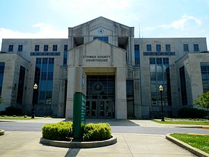
 Etowah County Courthouse in Gadsden | |
 Location within the U.S. state of Alabama | |
 Alabama's location within the U.S. | |
| Coordinates: 34°03′00″N 86°02′00″W / 34.05°N 86.033333333333°W | |
| Country | |
| State | |
| Founded | December 1, 1868 |
| Seat | Gadsden |
| Largest city | Gadsden |
| Area | |
| • Total | 549 sq mi (1,420 km2) |
| • Land | 535 sq mi (1,390 km2) |
| • Water | 14 sq mi (40 km2) 2.5% |
| Population (2020) | |
| • Total | 103,436 |
| • Estimate (2023) | 103,241 |
| • Density | 190/sq mi (73/km2) |
| Time zone | UTC−6 (Central) |
| • Summer (DST) | UTC−5 (CDT) |
| Congressional district | 4th |
| Website | www |
| |
Etowah County is a county located in the northeastern part of the U.S. state of Alabama. As of the 2020 census the population was 103,436.[1] Its county seat is Gadsden.[2] Its name is from a Cherokee word meaning "edible tree". In total area, it is the smallest county in Alabama, albeit one of the most densely populated. Etowah County comprises the Gadsden Metropolitan Statistical Area.
- ^ "State & County QuickFacts". United States Census Bureau. Retrieved September 12, 2023.
- ^ "Find a County". National Association of Counties. Archived from the original on May 31, 2011. Retrieved June 7, 2011.

