Fairview Heights | |
|---|---|
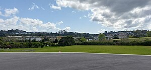
 View of Fairview Heights from Oteha | |
 | |
| Coordinates: 36°42′36″S 174°42′54″E / 36.710°S 174.715°E | |
| Country | New Zealand |
| City | Auckland |
| Local authority | Auckland Council |
| Electoral ward | Albany ward |
| Local board | Upper Harbour Local Board |
| Area | |
| • Land | 161 ha (398 acres) |
| Population (June 2024)[2] | |
| • Total | 4,680 |
| Postcode(s) | 0632 |
| Redvale | Okura | Torbay Heights |
| Dairy Flat |
|
Northcross |
| Albany | Oteha | Pinehill |
Fairview Heights is a suburb located on the North Shore of Auckland, New Zealand. It is under local governance of Auckland Council. The area is defined by Lonely Track Road on the north, East Coast Road on the east, Oteha Valley Road on the south, and the Auckland Northern Motorway on the west.[3] Until the end of the 20th century, the area was rural.[4]
- ^ Cite error: The named reference
Areawas invoked but never defined (see the help page). - ^ "Aotearoa Data Explorer". Statistics New Zealand. Retrieved 26 October 2024.
- ^ Harriss, Gavin. Fairview Heights, Auckland (Map). NZ Topo Map. Retrieved 11 June 2022.
- ^ Whangaparaoa (Map). 1:50000. NZMS260. LINZ / Lands and Survey. 1999. § R10.