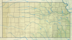
| Fall River State Park | |
|---|---|
| Location | Greenwood, Kansas, United States |
| Coordinates | 37°39′18″N 96°05′36″W / 37.65500°N 96.09333°W |
| Area | 980 acres (400 ha) |
| Elevation | 955 ft (291 m)[1] |
| Established | Unspecified |
| Visitors | 71,965 (in 2022)[2] |
| Governing body | Kansas Department of Wildlife, Parks and Tourism |
Fall River State Park is a state park in Greenwood County, Kansas USA, southwest of the city of Toronto. Located near the Flint Hills, Fall River State Park is 980 acres (4.0 km2) and can be accessed by going along 144 Highway 105. The state park features six different hiking trails including Casner Creek, Turkey Run, Post Oak, Overlook, Bluestem, and Catclaw.[3]
Activities at Fall River State Park include camping, hiking, picnicking, swimming, and boating and water skiing down the 2,450-acre (9.9 km2) Fall River for which the state park is named.
- ^ "Fall River State Park". Geographic Names Information System. United States Geological Survey. October 13, 1978. Retrieved November 28, 2012.
- ^ Self, Matthew (August 18, 2023). "Top 5 most popular Kansas state parks revealed". KSNT.
- ^ "Trails". Kansas Department of Wildlife, Parks and Tourism. Retrieved November 11, 2012.
