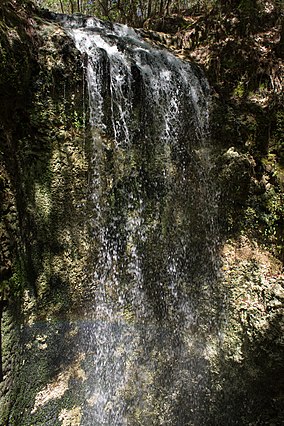
| Falling Waters State Park | |
|---|---|
 Falling Waters | |
| Location | Washington County, Florida, United States |
| Nearest city | Chipley, Florida |
| Coordinates | 30°43′41″N 85°31′43″W / 30.72806°N 85.52861°W |
| Area | 171 acres (69 ha) |
| Elevation | 239 ft (73 m)[1] |
| Established | 1962 |
| Named for | Falling Water Falls |
| Visitors | 30000 (in in 2008)[2] |
| Governing body | Florida Division of Recreation and Parks |
| Website | Falling Waters State Park |
Falling Waters State Park is a 171-acre (69 ha) Florida state park located three miles (5 km) south of Chipley, Washington County in northwestern Florida. The park contains a 73-foot (22 m) waterfall, the highest in the state [3] known as "Falling Waters Falls”.
- ^ "Falling Waters State Park". Geographic Names Information System. United States Geological Survey. August 28, 1987. Retrieved June 22, 2010.
- ^ Felsberg, Jay (February 5, 2008). "Falling Waters volunteers honored". Washington County News. Archived from the original on July 8, 2011. Retrieved June 22, 2010.
- ^ Cite error: The named reference
fwspwas invoked but never defined (see the help page).

