Falmouth, Massachusetts | |
|---|---|
 Main Street | |
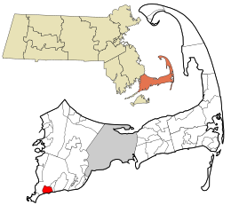
 Location in Barnstable County and the state of Massachusetts. | |
| Coordinates: 41°32′55″N 70°36′17″W / 41.54861°N 70.60472°W | |
| Country | United States |
| State | Massachusetts |
| County | Barnstable |
| Town | Falmouth |
| Area | |
| • Total | 2.25 sq mi (5.84 km2) |
| • Land | 2.09 sq mi (5.41 km2) |
| • Water | 0.17 sq mi (0.43 km2) |
| Elevation | 7 ft (2 m) |
| Population (2020) | |
| • Total | 3,818 |
| • Density | 1,828.54/sq mi (706.03/km2) |
| Time zone | UTC-5 (Eastern (EST)) |
| • Summer (DST) | UTC-4 (EDT) |
| ZIP codes | 02540, 02541, 02543 |
| Area code | 508 |
| FIPS code | 25-23070 |
| GNIS feature ID | 0616278 |
Falmouth is a census-designated place (CDP) consisting of the primary settlement in the town of Falmouth in Barnstable County, Massachusetts, United States. The population of the CDP was 3,799 at the 2010 census,[2] out of 31,532 in the town as a whole. It was named after Falmouth, Cornwall, England.
- ^ "2020 U.S. Gazetteer Files". United States Census Bureau. Retrieved May 21, 2022.
- ^ "Geographic Identifiers: 2010 Demographic Profile Data (G001): Falmouth CDP, Massachusetts". U.S. Census Bureau, American Factfinder. Archived from the original on February 12, 2020. Retrieved December 9, 2013.