Fayetteville Regional Airport Grannis Field | |||||||||||||||
|---|---|---|---|---|---|---|---|---|---|---|---|---|---|---|---|
 Aerial view of the airport | |||||||||||||||
 | |||||||||||||||
| Summary | |||||||||||||||
| Airport type | Public | ||||||||||||||
| Owner | City of Fayetteville | ||||||||||||||
| Operator | Fayetteville Airport Commission | ||||||||||||||
| Serves | Fayetteville metropolitan area and southeastern North Carolina | ||||||||||||||
| Location | Fayetteville, North Carolina | ||||||||||||||
| Elevation AMSL | 189 ft / 58 m | ||||||||||||||
| Coordinates | 34°59′28″N 078°52′49″W / 34.99111°N 78.88028°W | ||||||||||||||
| Website | www.flyfay.com | ||||||||||||||
| Map | |||||||||||||||
 | |||||||||||||||
| Runways | |||||||||||||||
| |||||||||||||||
| Statistics (2022) | |||||||||||||||
| |||||||||||||||
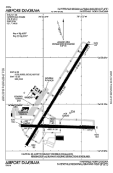
Fayetteville Regional Airport (IATA: FAY, ICAO: KFAY, FAA LID: FAY), also known as Grannis Field, is a public use airport in Cumberland County, North Carolina, United States. It is owned by the city of Fayetteville and located three nautical miles (6 km) south of its central business district.[1]
The airport has two runways and is served by a two-concourse terminal for commercial aviation and one separate terminal for general aviation traffic. The commercial terminal building was designed by Fayetteville architect Mason S. Hicks, a Fellow of the American Institute of Architects.
As per Federal Aviation Administration records, the airport had 202,597 passenger boardings (enplanements) in calendar year 2008,[3] 231,002 enplanements in 2009, and 258,986 in 2010.[4] It is included in the National Plan of Integrated Airport Systems for 2011–2015, which categorized it as a primary commercial service airport (more than 10,000 enplanements per year).[5]
- ^ a b FAA Airport Form 5010 for FAY PDF. Federal Aviation Administration. effective July 13, 2023.
- ^ Fayetteville Regional Airport, official site
- ^ "Enplanements for CY 2008" (PDF, 1.0 MB). CY 2008 Passenger Boarding and All-Cargo Data. Federal Aviation Administration. December 18, 2009.
- ^ "Enplanements for CY 2010" (PDF, 189 KB). CY 2010 Passenger Boarding and All-Cargo Data. Federal Aviation Administration. October 4, 2011.
- ^ "2011–2015 NPIAS Report, Appendix A" (PDF). National Plan of Integrated Airport Systems. Federal Aviation Administration. October 4, 2010. Archived from the original (PDF, 2.03 MB) on September 27, 2012.


