Fernando Luis Ribas Dominicci Airport Isla Grande Airport Aeropuerto Isla Grande | |||||||||||
|---|---|---|---|---|---|---|---|---|---|---|---|
 | |||||||||||
| Summary | |||||||||||
| Airport type | Public | ||||||||||
| Owner | Puerto Rico Ports Authority | ||||||||||
| Serves | San Juan, Puerto Rico | ||||||||||
| Location | Isla Grande | ||||||||||
| Elevation AMSL | 10 ft / 3 m | ||||||||||
| Coordinates | 18°27′24″N 66°05′54″W / 18.45667°N 66.09833°W | ||||||||||
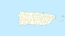
| Map | |||||||||||
 | |||||||||||
| Runways | |||||||||||
| |||||||||||
Fernando Luis Ribas Dominicci Airport (IATA: SIG, ICAO: TJIG, FAA LID: SIG), also commonly known as Isla Grande Airport, is an airport in Isla Grande, a district in the municipality of San Juan, Puerto Rico. It is owned by the Puerto Rico Ports Authority and is adjacent to the Puerto Rico Convention Center, the San Juan Bay, and the Pan American Cruise Ship Terminal, and overlooks Cataño. While Isla Grande's main activity is general aviation, it is still a commercial airport, handling domestic and international commercial flights.
It is included in the National Plan of Integrated Airport Systems for 2011–2015, which categorized it as a primary commercial service airport (more than 10,000 enplanements per year).[4]
- ^ FAA Airport Form 5010 for SIG PDF. Federal Aviation Administration. Effective April 5, 2012.
- ^ Airport information for Fernando Luis Ribas Dominicci Airport at Great Circle Mapper.
- ^ "Isla Grande Airport". Google Maps. Retrieved June 9, 2018.
- ^ "2011–2015 NPIAS Report, Appendix A" (PDF). National Plan of Integrated Airport Systems. Federal Aviation Administration. October 4, 2010. Archived from the original (PDF, 2.03 MB) on September 27, 2012.
