This article needs additional citations for verification. (November 2006) |
Feroke | |
|---|---|
Municipality | |
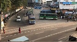
 Feroke bus stand | |
| Nickname: frk | |
| Coordinates: 11°11′0″N 75°51′0″E / 11.18333°N 75.85000°E | |
| Country | |
| State | Kerala |
| District | Kozhikode |
| Taluk | Kozhikode |
| Founded by | Parappanad Royal family |
| Government | |
| • Body | Municipality of feroke |
| Area | |
| • Total | 15 km2 (6 sq mi) |
| Population (2011) | |
| • Total | 54,074 |
| • Density | 3,600/km2 (9,300/sq mi) |
| Languages | |
| • Official | Malayalam, English |
| Time zone | UTC+5:30 (IST) |
| Vehicle registration | KL-85 |
| Lok Sabha constituency | Kozhikode |
| Towns | Feroke Town Karuvanthuruthy |
| Nearby Railway Station
| Feroke Railway Station
|
Feroke (IPA: [fɐroːkːɨ̆]) is a Municipality and a part of Kozhikode metropolitan area under Kozhikode Development Authority (K.D.A) in the Kozhikode district of the Indian state of Kerala.
Feroke municipality shares its borders with Kozhikode corporation, Ramanattukara municipality, Kadalundi panchayat and Chelembra panchayath.
Feroke is located 11 km away from Kozhikode city.
Feroke is developing as a suburb of Kozhikode city and Feroke is a part of Kozhikode urban area masterplan.[1][2]

- ^ "Master plan for Kozhikodeurban area likely to be revised". The Hindu. 13 June 2019. ISSN 0971-751X. Retrieved 23 April 2021.
- ^ "Master Plan | Kozhikode Municipal Corporation". kozhikodecorporation.lsgkerala.gov.in. Retrieved 20 May 2021.
