Ferrum, Virginia | |
|---|---|
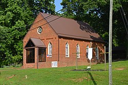
 Methodist church on Franklin Street | |
 Location of Ferrum, Virginia | |
| Coordinates: 36°55′35″N 80°0′40″W / 36.92639°N 80.01111°W | |
| Country | United States |
| State | Virginia |
| County | Franklin |
| Area | |
| • Total | 9.3 sq mi (24.0 km2) |
| • Land | 9.3 sq mi (24.0 km2) |
| • Water | 0.0 sq mi (0.0 km2) |
| Elevation | 1,296 ft (395 m) |
| Population (2010) | |
| • Total | 2,043 |
| • Density | 220/sq mi (85/km2) |
| Time zone | UTC−5 (Eastern (EST)) |
| • Summer (DST) | UTC−4 (EDT) |
| ZIP code | 24088 |
| Area code | 540 |
| FIPS code | 51-27712[1] |
| GNIS feature ID | 1466533[2] |
Ferrum is a census-designated place (CDP) in Franklin County, Virginia, United States. The population was 2,043 at the 2010 census, an increase of over fifty percent from the 1,313 reported in 2000. Ferrum is home to Ferrum College and its Blue Ridge Folklife Festival. It is part of the Roanoke Metropolitan Statistical Area.
- ^ "U.S. Census website". United States Census Bureau. Retrieved 2008-01-31.
- ^ "US Board on Geographic Names". United States Geological Survey. 2007-10-25. Retrieved 2008-01-31.