| Flat Bastion | |
|---|---|
Baluarte de Santiago (formerly) | |
| Part of Fortifications of Gibraltar | |
| Charles V Wall, Gibraltar in Gibraltar | |
 Section of the 1908 Ordnance Survey map of Gibraltar showing Flat Bastion. Note retired flank and orillon on west wall. Flat Bastion Magazine is highlighted in yellow. North is to the left. | |
 Section of 1608 map by Cristóbal de Rojas includes South Bastion and Flat Bastion, each with an orillon and a retired flank. | |
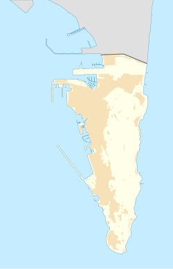
Location of Flat Bastion within Gibraltar. | |
| Coordinates | 36°08′05″N 5°21′05″W / 36.134820°N 5.351388°W |
| Type | Bastion |
| Site information | |
| Owner | Government of Gibraltar |
| Open to the public | Partly |
| Condition | Mostly derelict |
| Site history | |
| Materials | Masonry |
Flat Bastion is a bastion which projects southward from the Charles V Wall in the British Overseas Territory of Gibraltar. Once known as the St. Jago's Bastion or the Baluarte de Santiago in Spanish, the fortification was built by the Spanish in the mid 16th century and formed part of the southern defences of the city of Gibraltar, together with Charles V Wall, Southport Gates, Southport Ditch, and South Bastion. In 1859, six guns, four 12-pounders[a] and two 12-pound carronades, were installed on the bastion, and four years later, five 32-pounders [b] were mounted on the fortification.
Flat Bastion takes its name from the angle that its south-facing walls form with each other and with the Charles V Wall. Within the eastern portion of Flat Bastion is Flat Bastion Magazine. The bastion and magazine within it are separately listed with the Gibraltar Heritage Trust. The magazine has been restored and converted into a research facility.
Cite error: There are <ref group=lower-alpha> tags or {{efn}} templates on this page, but the references will not show without a {{reflist|group=lower-alpha}} template or {{notelist}} template (see the help page).
