Florence, Montana | |
|---|---|
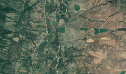
 US FSA aerial photograph of Florence in 2005 | |
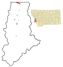
 Location of Florence, Montana | |
| Coordinates: 46°38′14″N 114°4′52″W / 46.63722°N 114.08111°W | |
| Country | United States |
| State | Montana |
| County | Ravalli |
| Area | |
| • Total | 0.77 sq mi (1.99 km2) |
| • Land | 0.77 sq mi (1.99 km2) |
| • Water | 0.00 sq mi (0.00 km2) |
| Elevation | 3,265 ft (995 m) |
| Population (2020) | |
| • Total | 821 |
| • Density | 1,069.01/sq mi (412.74/km2) |
| Time zone | UTC-7 (Mountain (MST)) |
| • Summer (DST) | UTC-6 (MDT) |
| ZIP code | 59833 |
| Area code | 406 |
| FIPS code | 30-26950 |
| GNIS feature ID | 0783551[2] |

Florence (Salish: čp̓úƛ̓us [3]) is a census-designated place (CDP) in Ravalli County, Montana. County Line Rd is on the northern edge of the city limits dividing it from Missoula County, Montana. The population was 821 at the 2020 census.
- ^ "ArcGIS REST Services Directory". United States Census Bureau. Retrieved September 5, 2022.
- ^ a b U.S. Geological Survey Geographic Names Information System: Florence, Montana
- ^ Tachini, Pete; Louie Adams, Sophie Mays, Mary Lucy Parker, Johnny Arlee, Frances Vanderburg, Lucy Vanderburg, Diana Christopher-Cote (1998). nyoʻnuntn q̓éymin, Flathead Nation Salish dictionary. Pablo, Montana: Bilingual Education Department, Salish Kootenai College. p. 53.
{{cite book}}: CS1 maint: multiple names: authors list (link)