| Florida River[1] | |
|---|---|
 | |
 | |
| Physical characteristics | |
| Source | |
| • location | Lillie Lake |
| • coordinates | 37°34′43″N 107°35′36″W / 37.57861°N 107.59333°W |
| Mouth | |
• location | Confluence with Animas |
• coordinates | 37°02′56″N 107°52′22″W / 37.04889°N 107.87278°W |
• elevation | 5,994 ft (1,827 m) |
| Basin features | |
| Progression | Animas—San Juan—Colorado |
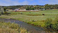
Florida River is a 61.7-mile-long (99.3 km)[2] tributary of the Animas River in La Plata County, Colorado.
The river's source is Lillie Lake in the Weminuche Wilderness. After being impounded by the Lemon Dam to form Lemon Reservoir about fifteen miles northeast of Durango, it joins the Animas River south of Durango on the Southern Ute Indian Reservation near the New Mexico state line.
Florida is a name derived from Spanish meaning "little flower".[3]

- ^ "Florida River". Geographic Names Information System. United States Geological Survey, United States Department of the Interior. Retrieved 2011-01-31.
- ^ U.S. Geological Survey. National Hydrography Dataset high-resolution flowline data. The National Map Archived 2012-03-29 at the Wayback Machine, accessed March 21, 2011
- ^ Dawson, John Frank. Place names in Colorado: why 700 communities were so named, 150 of Spanish or Indian origin. Denver, CO: The J. Frank Dawson Publishing Co. p. 21.