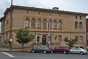
Floyd County | |
|---|---|
 | |
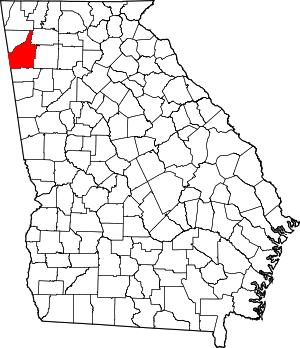
 Location within the U.S. state of Georgia | |
 Georgia's location within the U.S. | |
| Coordinates: 34°16′N 85°13′W / 34.26°N 85.22°W | |
| Country | |
| State | |
| Founded | December 3, 1832 |
| Named for | John Floyd |
| Seat | Rome |
| Largest city | Rome |
| Area | |
• Total | 518 sq mi (1,340 km2) |
| • Land | 510 sq mi (1,300 km2) |
| • Water | 8.6 sq mi (22 km2) 1.7% |
| Population (2020) | |
• Total | 98,584 |
• Estimate (2023) | 100,113 |
| • Density | 190/sq mi (73/km2) |
| Time zone | UTC−5 (Eastern) |
| • Summer (DST) | UTC−4 (EDT) |
| Congressional district | 14th |
| Website | floydcountyga.gov |
Floyd County is a county in the Northwest region of the U.S. state of Georgia. As of the 2020 United States Census, the population was 98,584.[1][2] The county seat is Rome.[3] Floyd County comprises the Rome, Georgia metropolitan statistical area.
- ^ "State & County QuickFacts". United States Census Bureau. Archived from the original on July 3, 2011. Retrieved June 22, 2014.
- ^ US 2020 Census Bureau report, Floyd County, Georgia
- ^ "Find a County". National Association of Counties. Archived from the original on May 31, 2011. Retrieved June 7, 2011.

