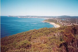
| Forresters Beach Central Coast, New South Wales | |||||||||||||||
|---|---|---|---|---|---|---|---|---|---|---|---|---|---|---|---|
 Forresters Beach | |||||||||||||||
 | |||||||||||||||
| Coordinates | 33°24′25″S 151°28′34″E / 33.407°S 151.476°E | ||||||||||||||
| Population | 2,900 (2016 census)[1] | ||||||||||||||
| • Density | 1,160/km2 (3,000/sq mi) | ||||||||||||||
| Postcode(s) | 2260 | ||||||||||||||
| Elevation | 18 m (59 ft) | ||||||||||||||
| Area | 2.5 km2 (1.0 sq mi) | ||||||||||||||
| Location |
| ||||||||||||||
| LGA(s) | Central Coast Council | ||||||||||||||
| Parish | Kincumber | ||||||||||||||
| State electorate(s) | Terrigal | ||||||||||||||
| Federal division(s) | Dobell | ||||||||||||||
| |||||||||||||||
Forresters Beach is a coastal suburb of the Central Coast region of New South Wales, Australia between Terrigal and Bateau Bay. It forms part of the Central Coast Council local government area. Forresters Beach's reef breaks are well known to surfers. Its name comes from Robert Forrester who purchased 50 acres (200,000 m2) of land in 1861.
- ^ Australian Bureau of Statistics (31 October 2012). "Forresters Beach (State Suburb)". 2011 Census QuickStats. Retrieved 11 March 2014.
