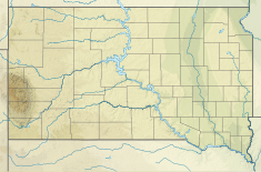
| Fort Randall Dam | |
|---|---|
 Fort Randall Dam and Power Plant, with Lake Francis Case in the background | |
| Country | United States |
| Location | Gregory County and Charles Mix County, South Dakota |
| Coordinates | 43°04′00″N 98°33′14″W / 43.066722°N 98.553897°W |
| Purpose | Flood control, hydroelectric power, irrigation, water supply, river navigation, and recreation[1] |
| Status | Operational |
| Construction began | 1946 |
| Opening date | 1953 |
| Construction cost | $200 million |
| Owner(s) | |
| Dam and spillways | |
| Type of dam | Rolled-earth fill |
| Impounds | Missouri River |
| Height | 165 ft (50 m) |
| Length | 10,700 ft (3,261 m) (including spillway) |
| Spillways | 21 40-foot × 29-foot tainter gates |
| Reservoir | |
| Creates | Lake Francis Case |
| Total capacity | 5.418 million acre⋅ft (7 billion m3) |
| Catchment area | 14,150 sq mi (36,648 km2) |
| Surface area | 102,000 acres (41,000 ha) |
| Maximum length | 107 mi (172 km) |
| Maximum water depth | 140 ft (43 m) |
| Normal elevation | 1,350–1,375 feet msl |
| Power Station | |
| Operator(s) | U.S. Army Corps of Engineers |
| Website U.S. Army Corps of Engineers - Fort Randall Project | |
Fort Randall Dam is a 2.03-mile-long (3 km) earthen dam which spans the Missouri River and impounds Lake Francis Case, the 11th-largest reservoir in the U.S.[2] The dam joins Gregory and Charles Mix counties, South Dakota, a distance of 880 river miles (1,416 km) upstream of St. Louis, Missouri, where the river joins the Mississippi River. The dam and hydroelectric power plant were constructed by and are currently[as of?] operated by the U.S. Army Corps of Engineers.
