Franklin County | |
|---|---|
|
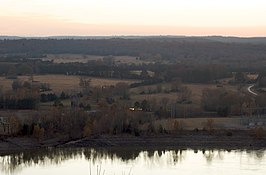
Clockwise from top: The Ozark Bridge over the Arkansas River, Franklin County Courthouse in Ozark, the Wiederkehr Wine Cellar near Altus, Sunset from Reed Mountain overlooking the Arkansas River Valley, Overlook at White Rock Mountain in the Ozark National Forest, Franklin County Courthouse in Charleston | |
 Location within the U.S. state of Arkansas | |
 Arkansas's location within the U.S. | |
| Coordinates: 35°31′15″N 93°52′33″W / 35.520833333333°N 93.875833333333°W | |
| Country | |
| State | |
| Founded | December 19, 1837 |
| Named for | Benjamin Franklin |
| Seat | Ozark (northern district); Charleston (southern district) |
| Largest city | Ozark |
| Area | |
| • Total | 620 sq mi (1,600 km2) |
| • Land | 609 sq mi (1,580 km2) |
| • Water | 11 sq mi (30 km2) 1.7% |
| Population (2020) | |
| • Total | 17,097 |
| • Estimate (2023) | 17,468 |
| • Density | 28/sq mi (11/km2) |
| Time zone | UTC−6 (Central) |
| • Summer (DST) | UTC−5 (CDT) |
| Congressional district | 4th |
Franklin County is a county in Arkansas. As of the 2020 census, the population was 17,097.[1] The county has two county seats, Charleston and Ozark.[2] The county was formed on December 19, 1837, and named for Benjamin Franklin,[3] American statesman. Franklin County is a damp county, with alcohol sales allowed except in Prairie & Alix townships, and limits on liquor sales in the city of Branch.[4]
- ^ "Census - Geography Profile: Franklin County, Arkansas". United States Census Bureau. Retrieved January 19, 2023.
- ^ "Find a County". National Association of Counties. Archived from the original on May 31, 2011. Retrieved June 7, 2011.
- ^ Gannett, Henry (1905). The Origin of Certain Place Names in the United States. Govt. Print. Off. pp. 131.
- ^ "Wet/Dry Status of Arkansas Counties". University of Arkansas System Division of Agriculture. Retrieved April 12, 2023.


