Franklin County | |
|---|---|
 The Franklin County Courthouse in Union | |
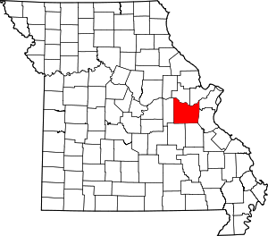
 Location within the U.S. state of Missouri | |
 Missouri's location within the U.S. | |
| Coordinates: 38°25′N 91°05′W / 38.41°N 91.08°W | |
| Country | |
| State | |
| Founded | December 11, 1818 |
| Named for | Benjamin Franklin |
| Seat | Union |
| Largest city | Washington |
| Area | |
• Total | 931 sq mi (2,410 km2) |
| • Land | 923 sq mi (2,390 km2) |
| • Water | 8.0 sq mi (21 km2) 0.9% |
| Population (2020) | |
• Total | 104,682 |
| • Density | 110/sq mi (40/km2) |
| Time zone | UTC−6 (Central) |
| • Summer (DST) | UTC−5 (CDT) |
| Congressional district | 2nd |
| Website | www |
Franklin County is located in the U.S. state of Missouri. At the 2020 census, the population was 104,682.[1] Its county seat is Union.[2] The county was organized in 1818 and is named after Founding Father Benjamin Franklin.[3][4] Franklin County is part of the St. Louis, MO-IL Metropolitan Statistical Area and contains some of the city's exurbs. It is located along the south side of the Missouri River. The county has wineries that are included in the Hermann AVA (American Viticultural Area) and is part of the region known as the Missouri Rhineland, which extends on both sides of the Missouri River.
- ^ "Explore Census Data".
- ^ "Find a County". National Association of Counties. Archived from the original on May 31, 2011. Retrieved June 7, 2011.
- ^ Gannett, Henry (1905). The Origin of Certain Place Names in the United States. Govt. Print. Off. p. 131.
- ^ Eaton, David Wolfe (1916). How Missouri Counties, Towns and Streams Were Named. The State Historical Society of Missouri. p. 166.
